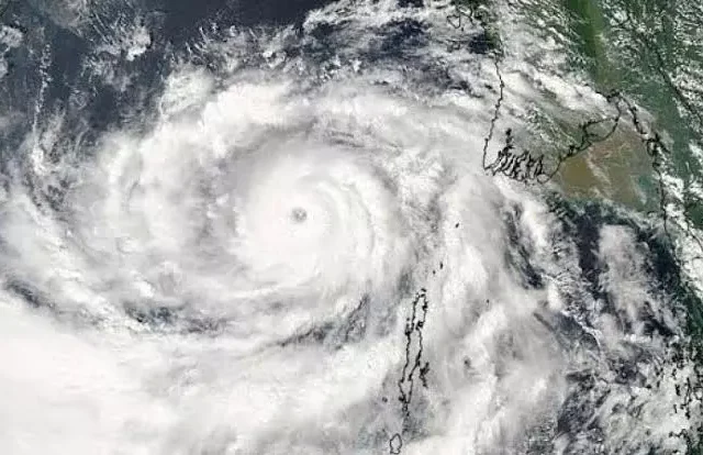
Cyclone Arnab Live Updates: Landfall Near Yanam Wednesday, Track Map

Image: Odisha Tourism / The Daily Pioneer
Very severe cyclonic storm Arnab is expected to cross the Andhra Pradesh coast close to the south of Yanam, near Kakinada, by about 11:30 am on Wednesday, 28 October, the India Meteorological Department (IMD) said. The storm, which formed over the Bay of Bengal and intensified on Monday night, is moving west-north-west towards the coast and is likely to hit with sustained winds of 125–135 km/h gusting to 150 km/h, a storm surge of one to two metres near Kakinada and Yanam, and extremely heavy rain over coastal Andhra Pradesh and south Odisha. Andhra Pradesh and Odisha have moved people from low-lying areas, shut schools and stopped fishing, and Kakinada port is flying Great Danger Signal X, the highest on the scale.
The question tonight is whether evacuation has kept pace with the forecast. Andhra Pradesh’s disaster management authority estimated that about four lakh people needed to be moved; by Monday night nearly 50,000 had been, its managing director Prakhar Jain told Reuters. On Tuesday about 89,000 were reported moved from the Kakinada coast alone, and Odisha said it had moved 48,010 people in eight districts. No deaths linked to Arnab had been reported by officials by Tuesday night. IPB is tracking the storm on the map below and will update this page every hour until Arnab weakens over land.
Track Cyclone Arnab
Tap a point, a city or a shaded area for details. Use the buttons to switch layers or zoom to the coast.
About this map: storm positions are taken from IMD bulletins and added each hour as new ones come in. The dotted line after landfall shows only the direction IMD has described (west-north-west towards Chhattisgarh, then north and north-east) and is not an exact forecast track. Shaded areas mark where IMD or state and national authorities have issued alerts; they are not exact district boundaries.
Live timeline (IST)
Newest first. Updated every hour as IMD bulletins and official information come in.
- NEW
Where Arnab is tonight. At a review on Tuesday evening, officials told Chief Minister N Chandrababu Naidu that the storm was about 167 km from Yanam and had been moving towards the coast at about 23 km/h over the previous six hours, his office said. IMD’s forecast is unchanged: landfall close to the south of Yanam by about 11:30 am on Wednesday, with winds of 125–135 km/h gusting to 150 km/h. Expect winds and rain to build along the Kakinada, Konaseema and East Godavari coast through the night. No deaths linked to Arnab had been reported by officials in the sources IPB checked.
Odisha ghat roads closed. The Kandhamal district administration suspended traffic on the Kalinga Ghat and Daringbadi–Gajalabadi ghat sections of National Highway 59 until 29 October because of the landslide risk, ETV Bharat reported.
Red alert in Bastar. IMD has issued a red alert for 28 October for Kondagaon, Bastar, Sukma, Dantewada and nearby districts of Chhattisgarh, and an orange alert for Raipur and central Chhattisgarh, ETV Bharat reported. Up to 100 mm of rain may fall in parts of the Surguja and Bilaspur divisions on 29 October.
Naidu’s instructions to collectors. The Chief Minister told district collectors to restore power as quickly as possible if lines go down, keep food and drinking water stocked in relief camps, move everyone from low-lying areas and make full use of the NDRF and SDRF teams already in place, his office said.
313 rescue teams in Odisha. Odisha has deployed 244 fire service teams, 60 Odisha Disaster Rapid Action Force teams and nine NDRF teams across 20 districts, the state’s information department said.
22 more trains cancelled or cut short. Express and passenger trains linking Visakhapatnam, Koraput, Kirandul, Jagdalpur, Rourkela, Sambalpur, Rayagada, Howrah, Bhubaneswar and Secunderabad will be cancelled or regulated on different dates between 27 October and 5 November, ETV Bharat reported. They include the Visakhapatnam–Kirandul Express (29 October to 4 November) and the Howrah–Jagdalpur Samaleswari Express (27 to 30 October). The Bhubaneswar–Jagdalpur Hirakhand Express will end at Rayagada from 27 to 30 October.
Telangana red alert, rail advisory. South Central Railway said cancellations and diversions will be sent by SMS to passengers with reserved tickets, and asked travellers to check NTES or call 139 before leaving. IMD has a red alert for 28 October in Khammam, Bhadradri Kothagudem, Mulugu and Mahabubabad, with heavy rain also likely in Warangal, Hanumakonda, Suryapet and Nalgonda on 28 and 29 October.
Odisha readies 1,735 shelters. The state has released ₹19 crore for relief and restricted movement in landslide-prone areas, an official spokesperson said.
Rain in Puri. Heavy rain fell across Puri district. The administration has placed pumps at points prone to waterlogging, including Grand Road and Marine Drive, deployed 98 lifeguards in three shifts on the Puri and Chandrabhaga beaches and suspended passenger boats at Satapada, ETV Bharat reported.
IMD position. The storm was centred near 16.2°N, 83.3°E, about 140 km south-east of Kakinada, 170 km south of Visakhapatnam and 230 km east of Machilipatnam, moving west-north-west at 18 km/h, IMD said. It is under watch by the Doppler weather radars at Visakhapatnam and Machilipatnam.
31 NDRF teams deployed. All 31 National Disaster Response Force teams requested have been deployed across Andhra Pradesh, Yanam, Odisha, Telangana and Chhattisgarh, NDRF DIG Mohsen Shahedi told IANS.
48,010 moved in Odisha. Special Relief Commissioner Rajesh Prabhakar Patil said 48,010 people had been moved from eight districts by 11 am: Nabarangpur 11,270, Gajapati 11,000, Malkangiri 9,850, Ganjam 6,500, Kalahandi 2,415, Nuapada 1,675 and Rayagada 300. Gopalpur port in Ganjam has also taken in 34 fishing boats from Andhra Pradesh.
Storm peaks at sea. Arnab’s sustained winds reached 150–160 km/h gusting to 180 km/h over the sea by late morning, IMD said, and it is expected to weaken somewhat before landfall. IMD Director General Mrutyunjay Mohapatra said seawater could rise one to 1.5 metres above normal in low-lying areas, with East Godavari likely to see the highest surge, and that waves of up to 14 metres made the sea unsafe for all boats. About 89,000 people have been moved to 101 relief camps on the Kakinada coast, seawater has entered parts of Uppada, and Visakhapatnam’s beaches are closed, The Daily Pioneer reported. IMD has warned of the “total destruction” of thatched houses and damage to power poles and standing crops.
Highest danger signal at Kakinada. Kakinada port is under Great Danger Signal X; Visakhapatnam, Gangavaram and Bheemunipatnam under IX; Machilipatnam and Nizampatnam under VIII, IMD’s coastal bulletin said. In Andhra Pradesh, 2,131 cyclone shelters are open across 20 districts, 30,043 fishing boats have been brought ashore, 1,351 pregnant women have been moved to hospitals, and cyclone alerts are going to 2.70 crore mobile phones in 18 districts, officials said. South Coast Railway said more than 70 trains had been cancelled, and flights were cancelled at Visakhapatnam, Vijayawada (Gannavaram) and on Chennai routes.
IMD raises landfall wind forecast. The storm was about 220 km south-south-east of Visakhapatnam, moving west-north-west at 20 km/h. IMD raised its landfall wind forecast to 125–135 km/h gusting to 150 km/h, from 115–125 km/h gusting to 140 km/h earlier.
Arnab moving west. The very severe cyclonic storm was centred near 15.9°N, 84.8°E, about 260 km south-east of Visakhapatnam and 300 km east-south-east of Kakinada, moving west at 22 km/h, IMD said. Rain and strong winds had already reached Bhubaneswar and Cuttack.
Arnab becomes a very severe cyclone. The storm intensified into a very severe cyclonic storm on Monday night, IMD said. The Centre’s National Crisis Management Committee, chaired by Cabinet Secretary T V Somanathan, asked agencies to aim for zero loss of life and to alert Bihar and east Uttar Pradesh as well. Andhra Pradesh released ₹27 crore to 20 districts for relief, including ₹2 crore each to Bapatla, Krishna, Konaseema, East Godavari, West Godavari, Kakinada and Anakapalli. By Monday night nearly 50,000 people had been moved to shelters in the state, out of an estimated four lakh who needed to move, APSDMA’s Prakhar Jain told Reuters.
Landfall Near Yanam by Wednesday Forenoon
IMD expects Arnab to cross the Andhra Pradesh and Yanam coast between Bapatla and Visakhapatnam, close to the south of Yanam, by about 11:30 am on Wednesday, as a very severe cyclonic storm. Sustained winds at landfall are forecast at 125–135 km/h, gusting to 150 km/h.
Also read Vidarbha, Marathwada Rain Alert: Showers Expected Oct 27-30
The storm surge, one to two metres above the astronomical tide, is expected to be highest near Kakinada and Yanam; IMD scientists have said low-lying villages up to 100 km on either side of the landfall point could be flooded. Isolated extremely heavy rain is forecast over coastal Andhra Pradesh, Yanam and Odisha on 27 and 28 October, and over Chhattisgarh on 28 October. Fishermen have been told not to go out to sea off Andhra Pradesh and Odisha until 29 October.
Rain Alerts From Chhattisgarh to Nepal After Landfall
After crossing the coast, the storm is expected to weaken and move west-north-west towards Chhattisgarh, then turn north and north-east, IMD scientist Dr Pattanaik said. Its winds will drop over land, but heavy rain can still flood towns, roads and fields.
Alerts already out: red for Bastar division in Chhattisgarh and four districts of Telangana on 28 October; orange for seven districts of Jharkhand till 30 October; heavy rain in seven south Bengal districts on 28 and 29 October, with Kolkata likely to see light to moderate rain; and a rain alert for Uttar Pradesh on 29 October. Nepal has asked people to stay on high alert from 29 to 31 October.
Evacuation Gap, Drought-Hit Farms and Power Lines
Andhra Pradesh says more than 1.2 crore people live along the storm’s projected path, and its own estimate was that about four lakh needed to move. Officials have released figures for some districts but not yet a single state-wide total for Tuesday. That gap is the number to watch before landfall.
The storm also reaches farmers already counting losses: Andhra Pradesh has declared 388 of its 688 mandals drought-affected this year, The Daily Pioneer reported, and IMD has warned that Arnab’s winds could damage paddy and horticulture crops on a large scale. The Centre has asked for essential services to be restored “in the shortest possible time”. The test of that promise comes after landfall, in the villages where power lines go down first.
Not the September ‘Arnab’ Reports
In late September, several outlets called a Bay of Bengal deep depression “Cyclone Arnab”, although IMD never named it; it crossed the Andhra–Odisha coast near Kalingapatnam as a deep depression. Reports from that time, including figures for deaths in Uttar Pradesh and Bihar, are about that earlier system, not the cyclone now approaching Yanam. The name Arnab, meaning sea in Bengali, was suggested by Bangladesh and was formally given to this storm on 26 October.
Andhra Pradesh Cyclone Helplines and Travel Updates
State control room: 112, 1070, 1800 425 0101. Mana Mitra WhatsApp: 9552300009.
District control rooms: Kakinada 0884-2356801; East Godavari 8832944455; Konaseema 8856293104; Visakhapatnam 0891-2590100 / 0891-2590102; Anakapalle 08924-222888; Srikakulam 08942-240557; Vizianagaram 8922236947; West Godavari 08816-299181; Krishna 08672-252399; Guntur 0863-2234014; Bapatla 08643-220226; Nellore 7995576699.
Visakhapatnam city operations centre: 1800-425-0009. Rail enquiries: 139, or NTES. Air India and IndiGo have asked passengers flying to or from Visakhapatnam and Vijayawada to check flight status before leaving.
Staying Safe During Landfall
If you live in a kutcha or thatched house or a low-lying area on the Andhra or south Odisha coast, move to the nearest cyclone shelter when officials ask. Stay away from beaches, rivers and canals; the surge can arrive before the strongest winds. Keep phones charged, store drinking water and essential medicines, and do not step out during landfall, even if the wind drops for a while: that may be the eye of the storm passing over. After the storm, keep clear of fallen power lines.
Read IPB’s earlier reports on the Kakinada evacuation, how Arnab formed, Odisha’s school closures and Andhra’s rescue teams, and more in Daily Updates.
Source: IMD cyclone bulletins (RSMC New Delhi). Also based on reporting by Al Jazeera with AFP and Reuters, The Daily Pioneer, ETV Bharat, The Watchers, Pragativadi, The News Minute and OdishaBytes (September system), and statements by the Andhra Pradesh Chief Minister’s Office, APSDMA and Odisha’s I&PR Department.
Image: Odisha Tourism / The Daily Pioneer. Map: IPB, using IMD positions; base map © OpenStreetMap contributors.
Get IPB News first