Cyclone Akvan Landfall: What IMD Forecasts and Where Reports Differ
Reports of IMD's bulletins differ on wind speed and storm surge, while Odisha plans for landslides and Andhra farmers brace for a third storm in weeks.
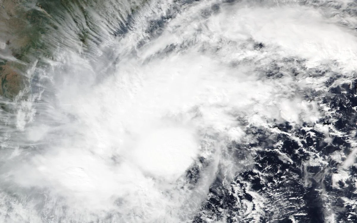
Image: NASA Worldview / NOAA-20 VIIRS
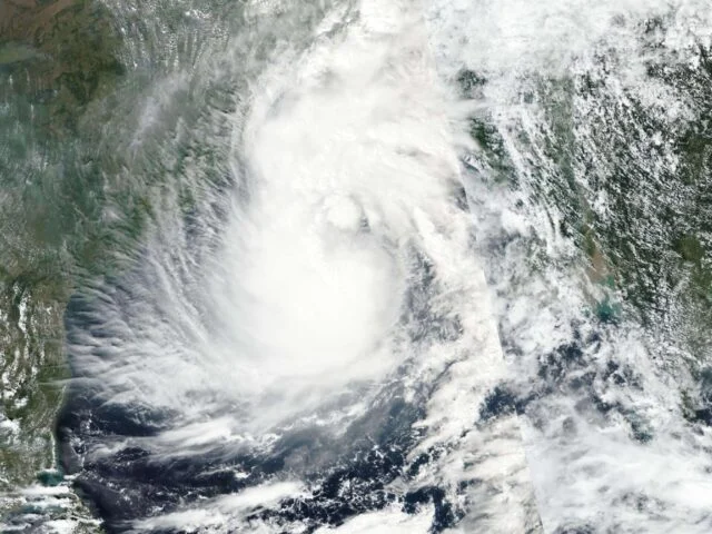
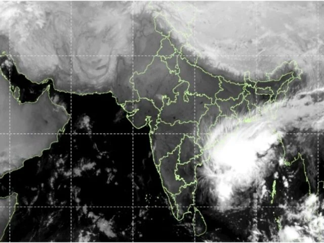
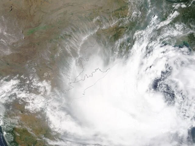
Cyclone Akvan is forecast to cross the Andhra Pradesh and Yanam coasts between Nellore and Visakhapatnam around noon on Friday, 20 November, but reports of the India Meteorological Department’s (IMD) latest bulletins do not agree on how strong it will be when it arrives. Business Today and Business Standard carried a forecast of a very severe cyclonic storm with winds of 120-130 km/h, gusting to 145 km/h. The Week and The Federal reported that the morning bulletin on 18 November projects a severe cyclonic storm with 100-110 km/h winds, gusting to 120 km/h. The gap matters because it decides how many roofs, power lines and standing crops are at risk, and how widely people are told to move.
How Akvan Got This Far
Akvan began as a well-marked low-pressure area over the southeast Bay of Bengal on 14 November, became a depression on the morning of 15 November and a cyclonic storm on the evening of 16 November, Business Standard reported. The name was suggested by Iran under the North Indian Ocean naming list. At 5:30 am on 18 November, IMD placed the system as a severe cyclonic storm about 580 km east of Chennai and 610 km south-southeast of Visakhapatnam, moving north-northwest at about 3 km/h. That crawl is one reason the forecast is uncertain: small changes in a slow storm’s path move the landfall point along a long stretch of coast.
Earlier forecasts gave a Nellore-to-Tuni window. The bulletins quoted on 18 November use Nellore to Visakhapatnam, including the Yanam coast. The Watchers, which summarised IMD’s National Bulletin No. 20 and the RSMC New Delhi advisory, reported that IMD rates its confidence in the current intensity as high, but only moderate for the track and the intensity forecast. It said global models diverge, and that some of them, including the European ECMWF model, weaken the storm below cyclonic-storm strength before landfall, while the official forecast still called for a very severe storm. IPB could not open the IMD PDF directly, so these model details rest on that outlet’s reading of the bulletin.
Also read Cyclone Akvan Landfall: Red Alert in Srikakulam, Vizianagaram
What IMD’s Bulletins Agree On
Several points are the same in every report IPB read. Landfall is expected around noon on 20 November. Heavy to very heavy rain is forecast for coastal Andhra Pradesh on 19 and 20 November, with isolated extremely heavy rain of 21 cm or more. South coastal Odisha gets heavy to very heavy rain from 19 to 21 November, and eastern Telangana on 20 and 21 November. Fishing is suspended in the Southwest Bay of Bengal until 20 November and in the West-central Bay until 21 November, and it is prohibited in the Northwest Bay from 19 to 21 November.
The Week’s account of the bulletin also lists a rainfall outlook for Gangetic West Bengal on 19 and 20 November, Jharkhand and Chhattisgarh on 20 and 21 November, and East Vidarbha and East Madhya Pradesh on 21 November, mostly light to moderate with heavy falls at isolated places. Business Standard reported orange rainfall alerts for 14 districts on 20 November: five in Andhra Pradesh (Alluri Sitharama Raju, Kakinada, Parvathipuram Manyam, Srikakulam and Vizianagaram), five in Odisha (Ganjam, Gajapati, Rayagada, Malkangiri and Koraput) and four in Telangana (Bhadradri Kothagudem, Khammam, Mahabubabad and Suryapet). IPB’s report on the Telangana alert has the district details for that state.
The Surge Number Has Come Down
The storm surge forecast has changed between bulletins. On the evening of 17 November, IMD’s all-India bulletin spoke of seawater 1 to 2 metres above the normal tide. The 18 November bulletin, as reported by The Week and Business Today, gives 0.4 to 1.2 metres above the astronomical tide, very likely to flood low-lying areas of Prakasam, Bapatla, Krishna, West Godavari, Konaseema, Kakinada and Visakhapatnam districts. Peak surge is expected over Bapatla, Krishna, West Godavari and Kakinada from the morning to the afternoon of 20 November, with about 0.3 metre staying on into the evening. IPB has updated its surge report with the lower figure.
IMD’s expected-damage list, carried by Business Today, is the part least affected by the argument over wind speed. It warns of major damage to thatched and kutcha houses in coastal Andhra Pradesh, with roofs blown off, and to standing crops, plantations and orchards, banana, papaya and drumstick trees among them. Power and communication poles, railway overhead lines, signalling systems, airports and heliports could be disrupted, and roads waterlogged.
Odisha Plans for Landslides, Not Wind
Odisha expects rain rather than damaging wind, and has built its plan around landslides. Business Standard reported that about 2.04 lakh people (204,070) may need to move, including 121,597 in Ganjam. The state has mapped 1,902 vulnerable locations across 87 blocks in eight districts and has 3,329 cyclone shelters available. More than 2,500 pregnant women have been identified, and over 100 have already been moved. Rayagada has listed about 55 landslide-prone villages for pre-emptive evacuation, and water is being released from the Harabhangi and Badanalla dams to lower reservoir levels.
The state’s Special Relief Commissioner Rajesh P Patil ordered boating, water sports and pleasure cruises suspended at vulnerable coastal sites and public access to unsafe beaches restricted. Disaster Management Minister Suresh Pujari said landslides are the main concern after Cyclone Arnab, when most of the state’s fatalities were linked to them. IMD Director General Mrutunjay Mohapatra said Odisha will see heavy rain “but not extremely heavy rain,” and the Bhubaneswar Met Centre said no red warning has been issued, as IPB reported in its earlier Odisha story. That report also gives Arnab’s Odisha toll at no fewer than 11 dead and six missing, 10 of the deaths in landslides in Ganjam and Kandhamal.
Andhra Pradesh Faces a Third Storm With Farms Already Hit
Akvan is the third cyclone to affect Andhra Pradesh in a few weeks, after Arnab in late October and Murasu in November. Business Standard’s report does not explain why the storms have come in a cluster, and IMD has not offered an explanation in the material IPB reviewed. What is documented is the cost so far: PTI reported on 16 November that the state’s crop losses from Arnab and Murasu were estimated at nearly Rs 7,000 crore, and that the state had asked the Centre for help. That is a reported estimate, not an official assessment, and no amount requested has been published. IPB’s report on the crop losses has the detail.
For farmers in those districts, a third storm means standing crops, harvested produce and drying yards are again exposed. The Federal reported that Chief Minister N Chandrababu Naidu directed officials to send out alerts, clear fallen trees and electric poles, and keep residents away from breached tanks and canals. South Coast Railway General Manager Sandeep Mathur reviewed safety arrangements and told officials to prepare for disruptions. Visakhapatnam Fishing Harbour has halted marine operations and recalled trawlers, according to The Hindu as cited by Business Standard.
Questions Still Without an Answer
Four things are not yet settled. IMD has not, in anything IPB could read, reconciled the two wind forecasts in circulation, and the next bulletin should show which one holds. The exact crossing point is still open across a stretch of coast several hundred kilometres wide, and the districts at highest risk could shift with it. The Andhra Pradesh government has not published how many people it plans to move or where, in the reports reviewed, while Odisha has put out detailed numbers. And no figure has been released for the support the Centre may give for the damage already caused by Arnab and Murasu.
Watch the Bulletins Through Friday
After landfall, The Watchers reported, IMD expects Akvan to weaken to a cyclonic storm by 11:30 pm on 20 November and to a depression by 11:30 am on 21 November. Rain, however, continues: coastal Andhra Pradesh is forecast to ease to isolated heavy falls in the north coast on 21 November, and south Odisha, eastern Telangana and several inland states have warnings running to that date. Residents of the coastal districts can follow IMD’s bulletins at mausam.imd.gov.in, and IPB will update its reports as each one is issued. All of IPB’s IMD coverage is under the IMD tag.
Source: IMD National Bulletin No. 20, issued 18 November 2026. Also based on reporting by The Federal, The Week, Business Today, Business Standard, Business Standard (explainer) and The Watchers.
Image: NASA Worldview / NOAA-20 VIIRS (public domain).